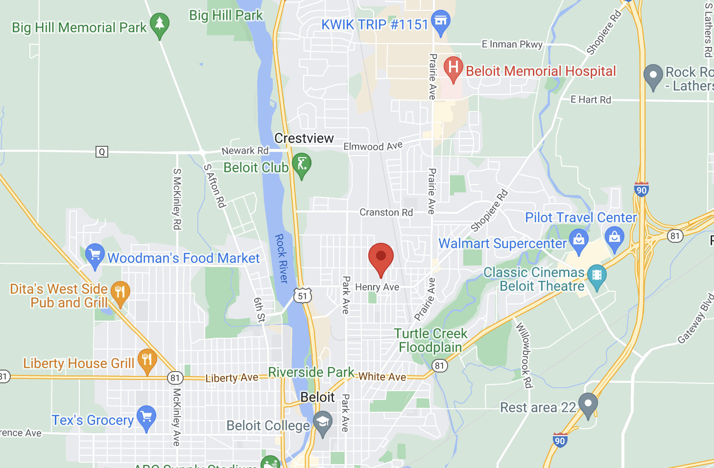
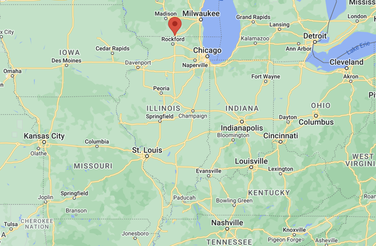
Community Overview

The City of Beloit is located along Interstate 39/90, just north of Wisconsin’s border with Illinois. The city center is located along the Rock River. Situated among four major metropolitan areas, Beloit has all the big-city amenities without the hassle of navigating a big city. With a population of more than 37,000, Beloit is conveniently located near Chicago to the southeast along Interstate 90, while Madison is less than an hour’s drive to the north. The city is directly connected to Milwaukee via Interstate Highway 43, which merges with interstate 39/90 in Beloit, forming a strategic transportation network in the nation’s heartland. Beloit is a 2011 Winner of the Great American Main Street, recognizing the community’s downtown revitalization efforts. The new Gateway Business Park is easily accessible on the east side of the interstate. Two sites in Gateway Business Park have been certified—a 70- and an 84-acre site.

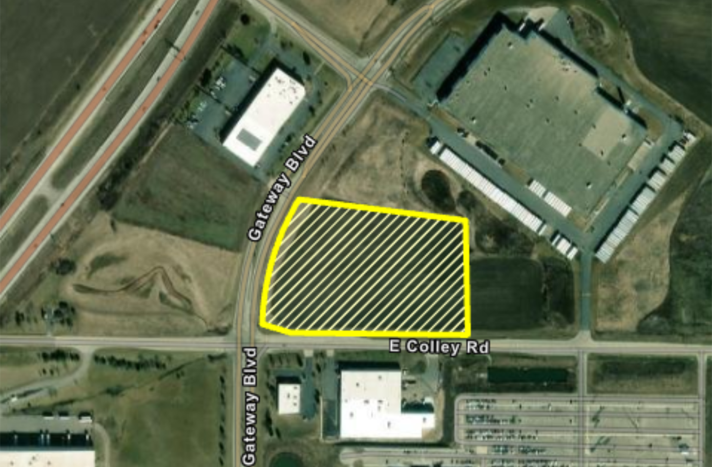
Number of acres remaining: 10 acres

  • A satellite view of the site outlined
  • Aerial map of site in proximity to other attractions in town
  • Aerial map of site in proximity to other states and bodies of water

Site Features

Location

General surroundings fit for industrial activity

Roadway access

Commercial and freight airport access

Flight path certifications not proximate of any airport

Single owner with documented willingness to sell

Utilities

No utility easements that would prevent development

American Land Trust Association (ALTA) survey

Fire insurance classification rating 3

Zoning

Industrial zoning

No known environmental impediments to immediate industrial development

No known archaeological/historical impediments to immediate industrial development

No known impediments to immediate development related to endangered species

Topography

No significant topography issues

10 developable acres remaining

Site not located on or adjacent to flood plain

Site Contact

Drew Pennington

President/CEO

Greater Beloit Economic Development Corporation

Site Resources

Community Profile

Beloit Airport Access

Site Overview

North Site Aerial ViewSouth Site Aerial ViewNorth Site ALTA SurveyFEMA-produced FIRM MapLetter Confirming OwnershipFlight Path InformationTopographical Map for the South SiteTopographical Map for the North SiteWetland Delineation ReportPhase 1 Environmental Assessment for the South SitePhase 1 Environmental Assessment for the North SiteGeotechnical ReportArcheological Study

Zoning

Zoning Letter for the South SiteZoning Map for the South SiteZoning Letter for the North SiteZoning Map for the North Site

Utility Details

Electrical Utility MapGas Utility MapWater Utility MapSewer Utility Map